
The AI-Viewer turns 3D infrastructure data into actionable insight.
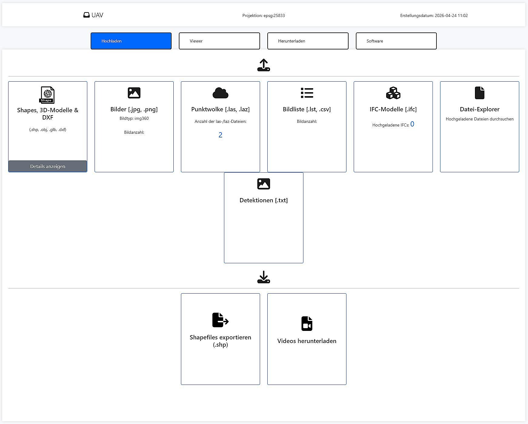
The MapTerra AI-Viewer is the central platform for point clouds, panoramas, orthophotos, GIS/CAD data, IFC models and AI results. It combines data from mobile mapping, drone/UAV surveys, terrestrial laser scanning, photogrammetry and existing GIS/CAD/BIM sources in one browser-based system. Project states from different epochs can be stored, synchronized and compared.
One data space for mobile mapping, drones, TLS, orthophotos and models
The AI-Viewer is more than a 3D viewer: it is the web workspace where technical project teams inspect, measure, compare, annotate and export infrastructure data.
- View point clouds, 360° panoramas, orthophotos and domain layers together
- Overlay GIS, DXF, GeoPackage, GeoJSON, LandXML and raster data
- Inspect IFC and 3D models in the context of LiDAR data
- Create 2D/3D measurements, profiles, areas, volumes and volume differences
- Use markers, attachments, project roles and exports for team workflows
- Publish AI detections and expert analytics as project layers
Built for large-scale infrastructure programs
MapTerra combines AI, viewer delivery and operational throughput. We are strongest where large networks, high data volumes and traceable outputs need to work together.
Why MapTerra is positioned differently today
Inspired by modern platform and service offerings, we design infrastructure workflows around usable outcomes: current capture, AI interpretation and direct delivery in the viewer instead of isolated data handover.
AI extraction of infrastructure assets
Traffic signs, markings, poles, vegetation, surfaces and additional asset classes are detected, classified and georeferenced automatically into usable data products.
Digital twins for planning and operations
Instead of isolated outputs, teams get robust 2D/3D foundations with attributes, conditions and visual evidence for planning, operations and documentation.
Viewer as the daily workspace
The MapTerra Viewer makes AI results directly accessible in the browser with GIS context, measurements and clean sharing workflows for many users.
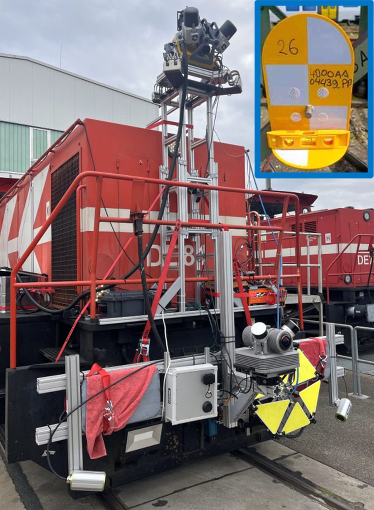
Mobile Mapping as a Service
Capture, processing, anonymization, viewer publishing and AI analytics come from one source as a scalable service model for recurring update cycles.
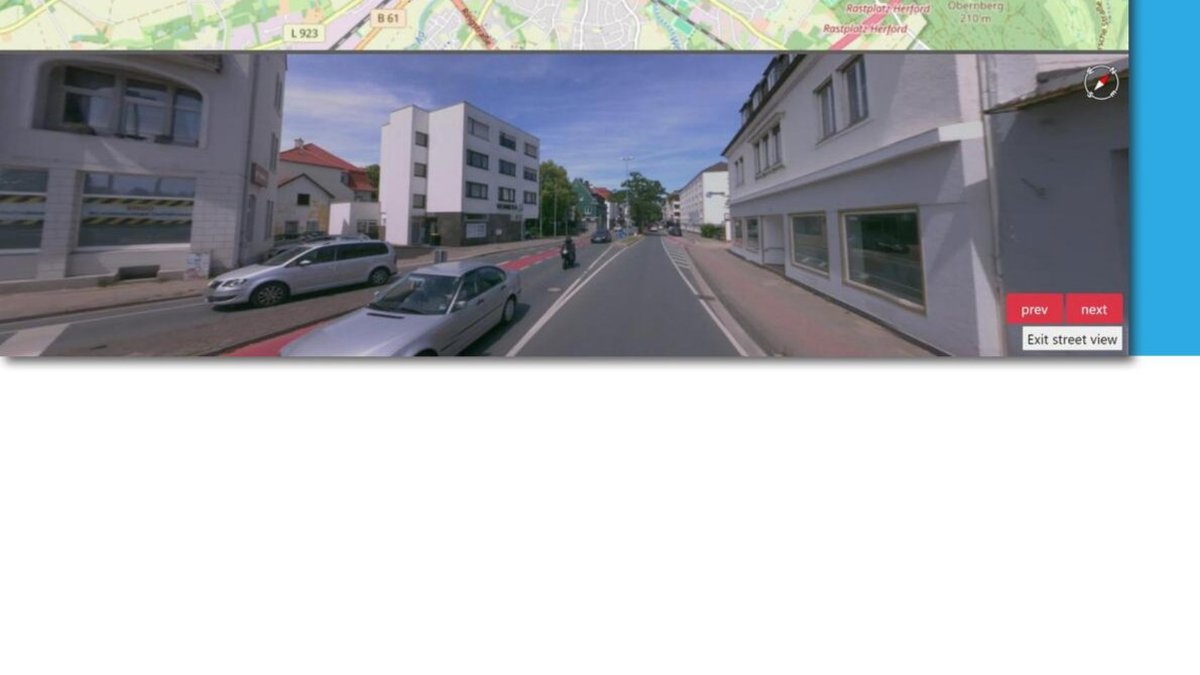
The viewer becomes the workspace for AI-enabled infrastructure projects
In the MapTerra Viewer, maps, imagery, point clouds and GIS data come together. AI outputs are not just exported—they become visible, verifiable and immediately usable in operational context.
- Synchronized navigation across map, image and 3D point cloud
- 2D/3D measurements, profiles, areas and volumes
- Attribute search, layer control and vectorization
- Topographic extractions and AI results in the same workspace
- GIS export, permissions and browser-based access for many parallel users
- Ideal for rail, motorway, asset and FTTH projects
Current capture, AI analytics and viewer publishing as one service
MapTerra delivers more than capture data. We provide a full update workflow: drive, process, handle sensitive content locally or in EU-oriented environments, generate AI outputs and publish everything in the viewer for project teams.
AI use cases for roads, rail and municipal infrastructure
The underlying data model can be transferred across infrastructure domains, from traffic management to asset operations.
Traffic & RTTI
Current mobility data, AI recognition of signs and roadside assets, plus change detection for continuous updates.
Asset management
AI-supported inventory and condition information provides a stronger basis for budgeting, maintenance and prioritization.
FTTH & route planning
Recognize surfaces, obstacles and roadside objects early to reduce site visits and create more robust designs.
Road condition
Automatically assess cracks, patches, potholes, curb damage and settlements from high-quality imagery and 3D data.
Digital twin
Point clouds, imagery and GIS become one traceable twin for operations, communication and evidence.
Data sovereignty
For sensitive infrastructure data, local or EU-based storage and processing is becoming increasingly important.
Want your website and offer to speak more clearly about AI and services?
We support projects from capture and AI evaluation through viewer delivery to GIS or CAD handover.