
The point cloud management system for infrastructure, construction and operations.
The MapTerra AI-Viewer brings LiDAR point clouds, mobile mapping data, drone/UAV data, terrestrial laser scans, 360° panoramas, orthophotos, GIS/CAD data, IFC models and AI detections into one shared, geodetically consistent web interface. Data from different sources and epochs can be managed, overlaid and compared in a single system.
What the AI-Viewer already delivers
The platform is built for real infrastructure projects: large datasets, multiple coordinate systems, domain-specific layers and data from mobile mapping, drone surveys, terrestrial laser scanning, photogrammetry, orthophotos and existing datasets—all reviewed collaboratively in the browser.
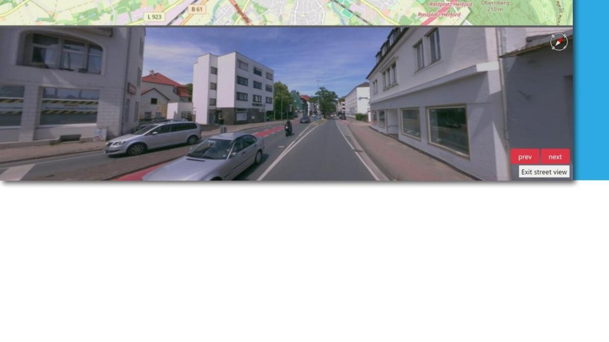
Point clouds, panoramas and 3D scenes
Point clouds from mobile mapping, drone photogrammetry and terrestrial laser scanning, 360° panoramas, image lists, orthophotos and other geodata are published, synchronized and navigable in 2D/3D context.
- free 3D navigation and street-view mode
- layers for point clouds, image positions, orthophotos and domain objects
- combination of multiple data sources in one project
- preparation for fast web visualization
GIS, CAD, raster data and coordinate reference
Shapefiles, DXF site plans, GeoPackage, GeoJSON, LandXML and GeoTIFFs can be integrated and visualized in the project coordinate system.
- project CRS and EPSG selection
- reprojection of DXF and vector data
- layer control, attributes and search
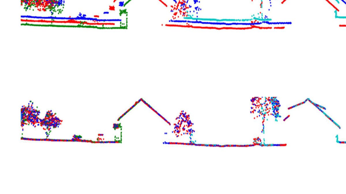
AI detections and expert analytics
Detections, domain layers and extracted objects can be added to the project, reviewed, attributed and delivered to specialist teams.
- detection files and object layers
- traffic signs, HRI, road and sidewalk assessment
- attribute review, QC and vectorization
- export for GIS and project workflows
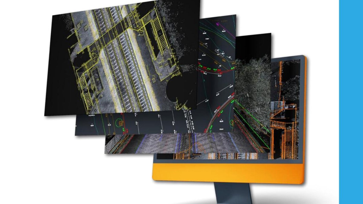
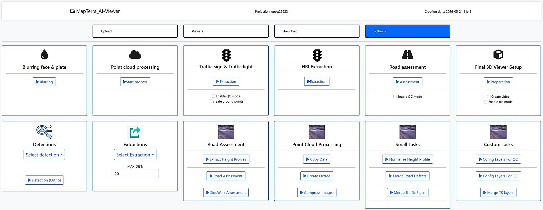
The AI-Viewer covers the full project data chain
Data is not only displayed. It is uploaded in a structured way, processed for web use, enriched with AI and domain-specific analytics, and delivered again as usable project outputs. This creates a continuous workflow for infrastructure, construction and asset data.
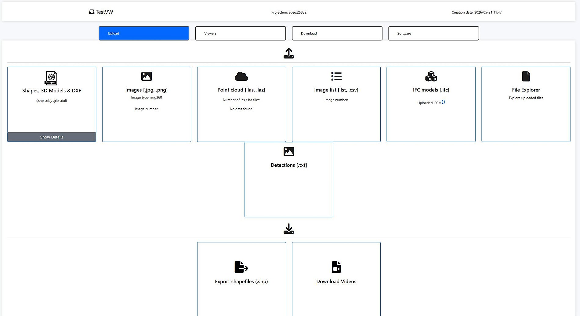
Combine data sources
Upload shape/vector data, 3D models, DXF site plans, images, panoramas, point clouds, image lists, IFC models and detection data — including a file explorer for project organization.
Process for web use
Point cloud processing, octree creation, image compression, final 3D viewer setup and optional video publishing make large datasets usable directly in the browser.
Integrate AI and domain analytics
Traffic signs & traffic lights, HRI extraction, road assessment, height profiles, sidewalk assessment, detections, extractions and QC modes are provided as domain tools in the project context.
Deliver results
Shapefiles, videos, point cloud cutouts, images, markers, vector objects and project information can be exported and reused in GIS, CAD, BIM or documentation workflows.
Geodetic tools for reliable decisions
The AI-Viewer supports measurement and validation workflows directly in maps, panoramas, point clouds and models. Raw data becomes traceable technical information.
- 2D distance and area measurement on the base map
- 3D point, distance, height, angle, profile and azimuth measurement
- rail-specific measurements to track axis and chainage line
- volume calculation, DTM horizon and volume differences between epochs
- snapping and measurements on IFC surfaces and point cloud points
- download and tabular management of measurement results
Models in the context of reality
IFC models can be displayed with point clouds, faded, focused and inspected via element properties. This prepares design-vs-reality and model review workflows directly in the viewer.
- IFC upload and georeferenced display
- element properties by double-click
- opacity, visibility and per-file controls
Multi-temporal and project-specific
Multiple project epochs can be retained and compared side by side. Map and 3D views remain synchronized, layers are filtered by epoch and changes in orthophotos, point clouds, models and domain layers become immediately visible.
Markers, attachments and sharing
Project teams can place markers in 2D and 3D, add notes and attachments, share links, control visibility and deliver content to authorized user groups.
Regions, objects and project files
Regions, point cloud cutouts, vector objects, markers, images and IFC models can be exported for GIS, CAD, BIM or documentation workflows.
Roles, groups, MFA and audit logs
The AI-Viewer supports project-specific access, user and group management, roles, MFA settings and audit logs for traceable project and data delivery.